


No entries have been mapped yet.
![]()
![]()
![]()
![]()
![]()
![]()
OR
Copy the link to @TyB Journo below
Dec 29 2024

We arrived. Two flights including an overnighter.
Lima Peru.
No time change. Yay
We arrived, then rested, and walked around the Lima region of Burranco. The arts district. The shops have all forms of artisan items \240from Peru. Beautiful wood furniture, clothing and woven items, including glass work!

The sitting room outside our hotel room

A Christmas tree in front of Hotel B

The Pacific Ocean, Lima Peru

Land Rover Station Wagon


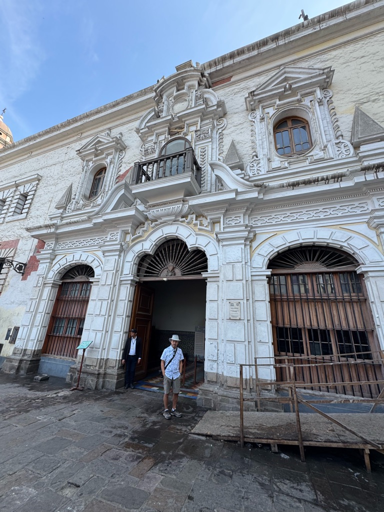
A Catholic Church in need of repair


Love Padlocks on a fence.


An artist district with little shops everywhere


Love the secret lane ways.

We visited Huaca Pucllan and had dinner at a restaurant right beside this Pre Inca site
Fascinating


All built up with residences around it.
The Spanish destroyed most of this site when they invade the Inca Empire in 1532.


A pre Inca site called Huana Pugllana built around 500 AD.


A lesson on making a Pisco Sour

Made from 5 different white and green grapes, in the Lima region

The Pisco Sour —
Pisco liquor, lemon juice, simple syrup and egg whites.
Tart and yummy

![]()
![]()
![]()
![]()
![]()
![]()
OR
Copy the link to @TyB Journo below
Dec 30 2024
A day in Lima.
We experienced a 4 hour private tour of the city.
Amazing city.

Santa Domingo Monestary

Catacombs below the monestary where the many thousands of people were buried, by choice.


Bodega Quadra was the first person to discover Vancouver Island


A Catholic procession through the city centre. With the Cardinal.

City centre. Judicial building , city hall, etc


There’s the Cardinal

St Francis Monestary.

Their Library. Books back to the 1700s in many languages.

Santa Rosa de Lima. The first female to be canonized by the Roman Pope in the 1600.


Milleflores region of Lima

The Park of Love.

The hillside has netting because it’s made of sandstone. It is desert like here and they do not get very much rain. That’s why the hills are still there.

Randy’s first beer

Tracy enjoying a Pisco Sour

Diner beside the ocean at Cala.


Sunset picture from the restaurant.

The seagull delivers the check.

![]()
![]()
![]()
![]()
![]()
![]()
OR
Copy the link to @TyB Journo below
Dec 31 2024
Today we flew from Lima Peru to Cusco Peru
After being picked up we proceeded to the Sulca Textile Museo
ABOUT SULCA TEXTILES MUSEUM – In their own words
Museo Sulca Textiles is situated in Cusco, Peru. The museum recreates fabrics and pieces from ancient Peru using ancestral techniques from the different Pre-Columbian Inca, Viceroyalty and Contemporary cultures. This is a place where the traditions of the North, South and Center of Peru come together.
The Sulca family who are current heirs to the knowledge of pre-Columbian textile art, a legacy of the great Wari cultural empire, currently oversee, re-value, preserve, elaborate, innovate and disseminate the fabric made with the specialized knowledge and textile techniques that influenced ancient Peru; this is their family legacy!
Visitors can also shop for the museum's unique collection of pieces. Moreover, here you will be able to watch different kinds of South American camelids, like the Llama, Alpaca and Vicuña.
The history of the textile art goes back to Pree Inca and Inca people

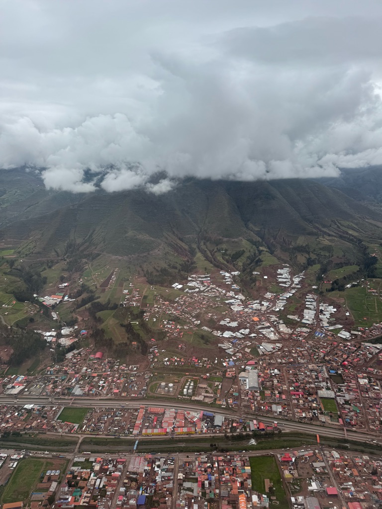
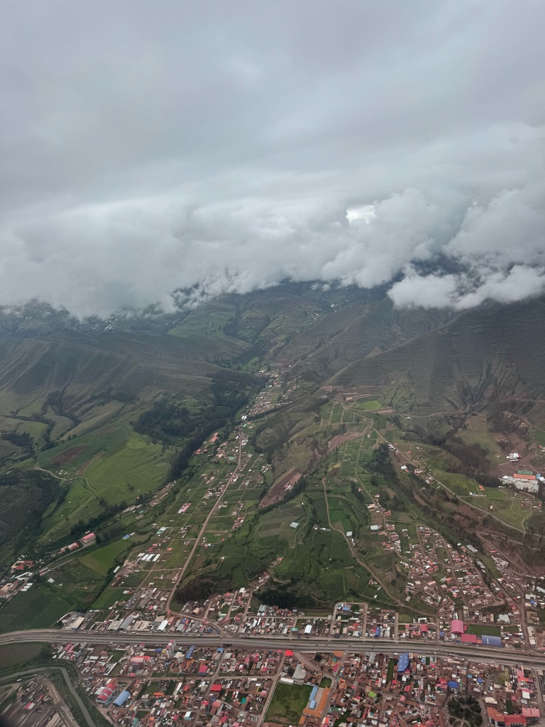
The view from the plane

Landing in Cusco

Very detailed wall hanging that will take up to 5 months to weave. The patterns tell the stories from the Incas.


Love his face

Llamas. Alpacas. And vicuñas.


Sacred Valley. They grow many types of corn, potatoes, and vegetable crops.


Stunning green mountainous region.
Peru just gets better and better.
😍
![]()
![]()
![]()
![]()
![]()
![]()
OR
Copy the link to @TyB Journo below
Dec 31 2024
Touring the Sacred Valley.
The Sacred Valley is a region in Peru's Andean highlands. Along with the nearby town of Cusco and the ancient city of Machu Picchu, it formed the heart of the Inca Empire. Stretching roughly 60 kilometers, it’s an area of fertile farmland and Spanish colonial villages like Pisac and Ollantaytambo. Pisac is known for its Sunday handicraft market and hilltop Incan citadel.

Chinchero Market


Learning how they spin, colour and weave the alpaca wool


Views of Sacred Valley


Moray. It is widely believed that the Moray ruins were used as an experimental farm by the Incas over 500 years ago. This theory was first proposed by anthropologist John Earls in 1975 and officially published in 1981. He supported this theory with several findings after spending weeks living at the site.


Terraces for crops. Bottoms terrace for young seeds. The hottest place to plant. And then loved them up as they grew.

Firstly, an Inca irrigation system, a series of channels fed by water from a reservoir located higher in the mountains, was engineered into the structures of terraces. He also noticed that the temperature difference from top to bottom ranged an astonishing 27 degrees Fahrenheit (12 degrees Celsius). He also observed that the sun hit each terrace at different angles and intensities.
Firstly, an Inca irrigation system, a series of channels fed by water from a reservoir located higher in the mountains, was engineered into the structures of terraces. He also noticed that the temperature difference from top to bottom ranged an astonishing 27 degrees Fahrenheit (12 degrees Celsius). He also observed that the sun hit each terrace at different angles and intensities.
Earl’s theory was that the Inca Empire used each terrace at Moray as its own microclimate. This allowed the Incas to study the effects of altitude, temperature, and sun absorption on crop growth to determine ecological niches suitable for crops to thrive. This experimentation allowed for the Incas to teach neighboring regions agricultural techniques for best crop production despite the differing altitudes and climates throughout the Andes and Peru. Earl’s theory illustrates how the Incas used their understanding of the environment to capitalize on the natural resources at their fingertips and it gives insight as to how the mighty Inca Empire expanded itself so widely throughout South America.


Ollantaytambo is a village in the Sacred Valley of south Peru, set on the Urubamba River amid snow-capped mountains. It's known for the Ollantaytambo ruins, a massive Inca fortress with large stone terraces on a hillside. Major sites within the complex include the huge Sun Temple and the Princess Baths fountain. The village's old town is an Inca-era grid of cobblestoned streets and adobe buildings.


Food storage building on the side of the mountains. Holding enough food for many people for many years.

Food storage building high up the mountain. Open doors for air flow


The face carved into the rock is called Wiracocha, the deity. The Incas believed that he was the creator of all.


Restaurant for Lunch.
And the 7 hour Sacred Valley tour is done.
Our guide Betty and driver Carlos are awesome.
![]()
![]()
![]()
![]()
![]()
![]()
OR
Copy the link to @TyB Journo below
Jan 01 2025
MACHA PICHU
The leading theory is that Machu Picchu was a private city for Incan royalty. The names of the buildings, their supposed uses, and their inhabitants, are the product of modern archaeologists based on physical evidence, including tombs at the site. Machu Picchu was built in the classical Inca style, with polished dry-stone walls. Its three primary structures are the Temple of the Sun, the Temple of the Three Windows,and the Intihuatana. From 1929 to 1971, Machu Picchu underwent extensive restoration and conservation work, including structural stabilization and artifact excavation, driven by government initiatives and research expeditions.[13] Most recent archaeologistsbelieve that Machu Picchu was constructed as an estate for the Inca emperor Pachacuti (1438–1472). The Inca built the estate around 1450 but abandoned it a century later, at the time of the Spanish conquest. According to the new AMS radiocarbon dating, it was occupied from c. 1420–1532.

Boarding Perurail for our 1.5 hour trip to Machu Pichu.
When returning they had dancing and a fashion show on board.


Views from the train as we travel 1.5 hours from Ollumtaytombo to Machu Pichu Pueblo
The Urubamba River surrounds the mountains where the Inca city of Machu Picchu is built and runs through the valley from the city of Ollantaytambo to the town of Aguas Calientes; Trains to Machu Picchu travel along the banks of the Urubamba River to the Inca city.

Machi Pichu Pueblo


We start our ascent to the sacred mountain as the Inca’s did too:). But we went by bus!!!!!


This is the route that we took. Route 2.

Very lush

We see the village of Machu Pichu with their stone homes, sacred places of worship and terraced agricultural areas

There was no mortar used in construction. And the structures were trapezoidal for stability in earthquakes.

Tracy loves her hiking poles.

Each home had separate walls. They had a canal that brought water to the city from a spring high up in the mountains.

Terraced agriculture.

The urban sector


The Temple of the Sun is a sacred Inca temple in Machu Picchu, Peru that was used for religious
The temple of the sun is also:
A sun dial
A window that allows the sun to shine inside on the summer and winter solstices
A carved stone in the center used for ceremonies honoring the sun
An underground cave with carved stone walls
A rectangular courtyard with nine cavities that may have been graves


One of the three Entrance Gates
It was an access way to the urban sector via the main trail.
![]()
![]()
![]()
![]()
![]()
![]()
OR
Copy the link to @TyB Journo below
Jan 02 2025

12 angle inca stone that is part of the palace that belonged to the Inkaa Roka


Our Lady of the Annunciation Cathedral.
Also home to the ‘ Black Jesus’. Black from the smoke from candles that burned around the statue. It is an idol thought to be the Lord of the Earthquakes — keeping earthquakes away.

The Temple of the Sun. The temple held mummies of the rulers wives and riches offerings.

Perfect build using only string for measuring and no mortar.

An example of their tong and groove architecture for stability.

A Cusco Nativity scene with Lammas.


Lunch. :)
![]()
![]()
![]()
![]()
![]()
![]()
OR
Copy the link to @TyB Journo below
Jan 03 2025
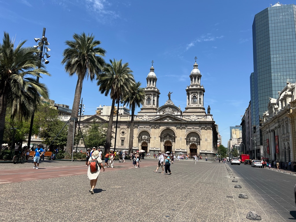
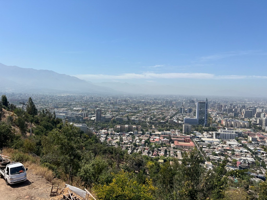
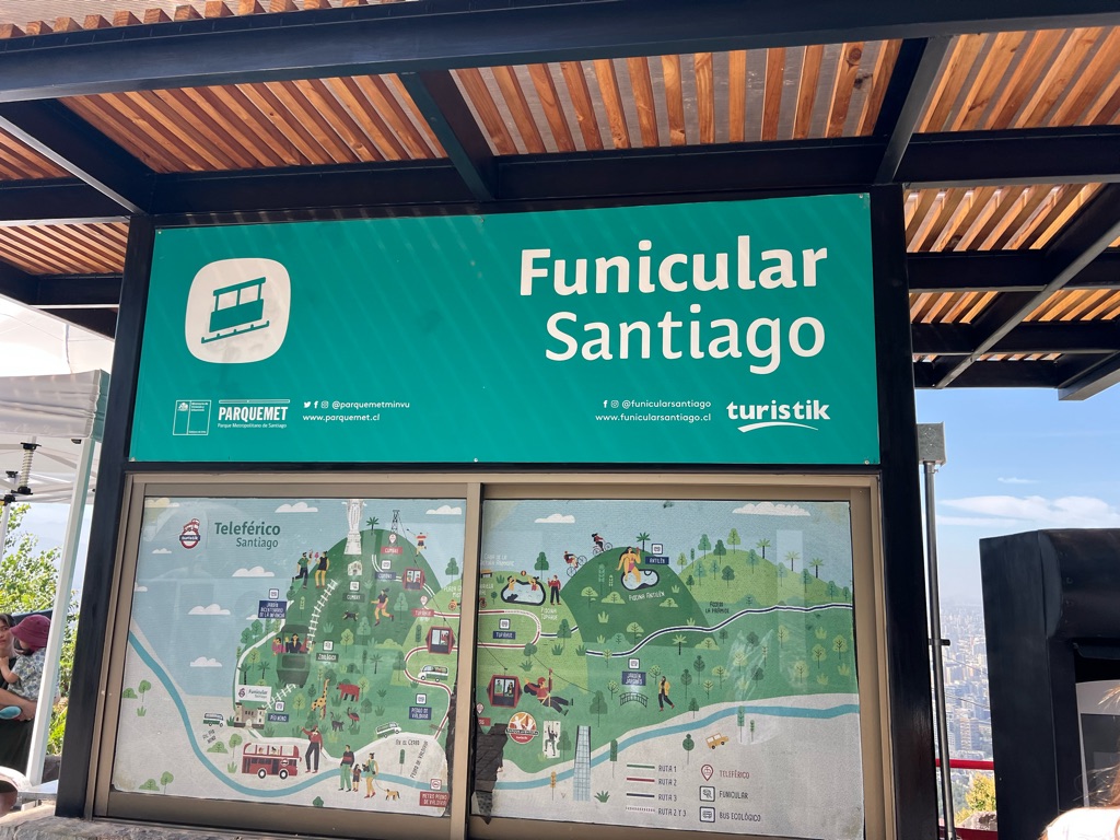
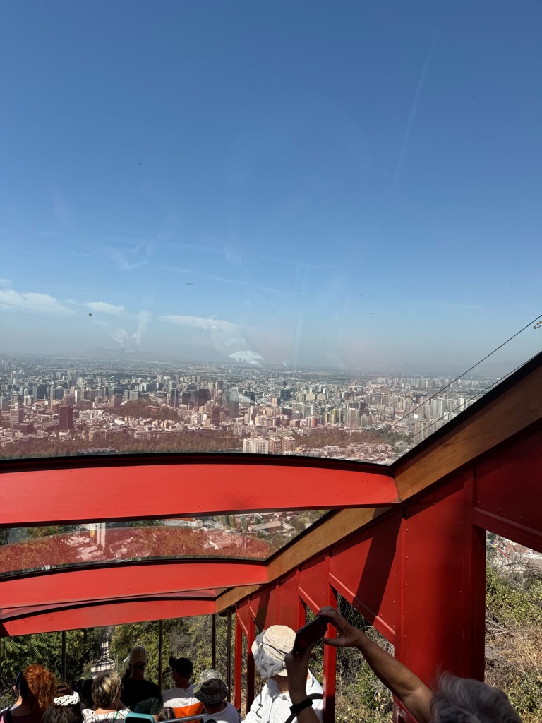
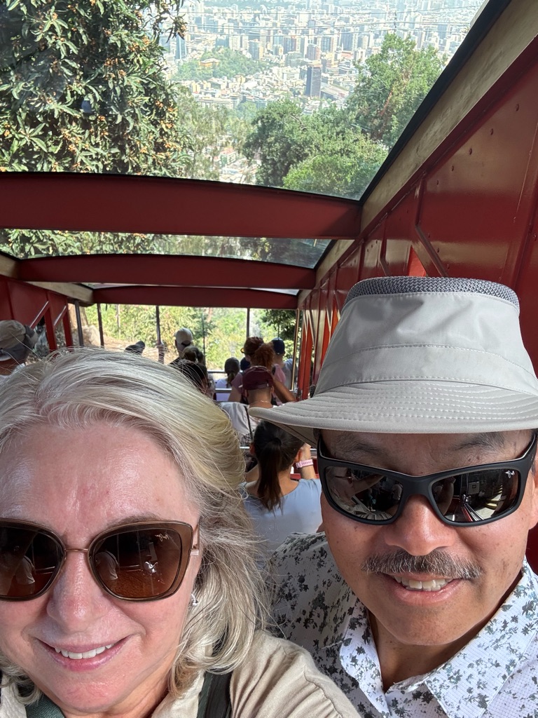
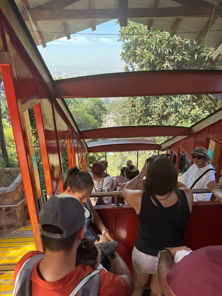
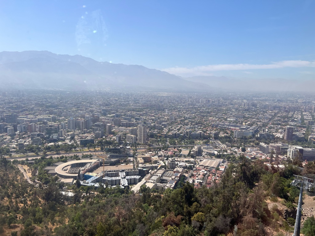
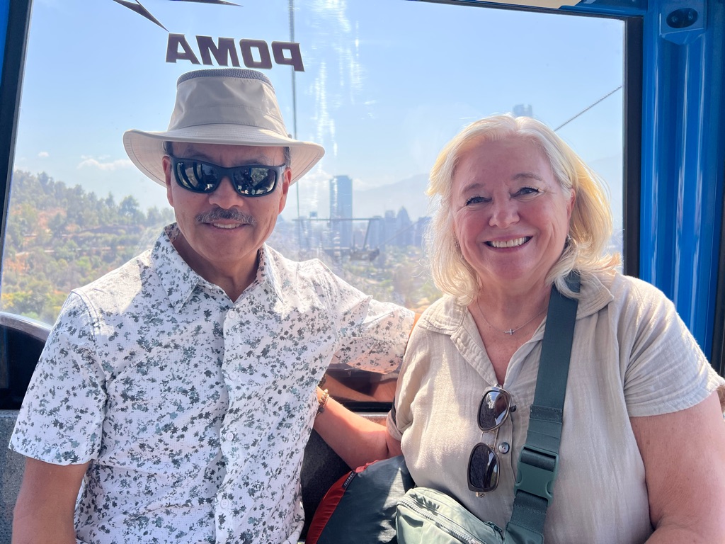
Good bye Cusco and Peru. Hello Chile.
Good by Peru.
We will miss you. !!!
![]()
![]()
![]()
![]()
![]()
![]()
OR
Copy the link to @TyB Journo below

![]()
![]()
![]()
![]()
![]()
![]()
OR
Copy the link to @TyB Journo below
Jan 05 2025
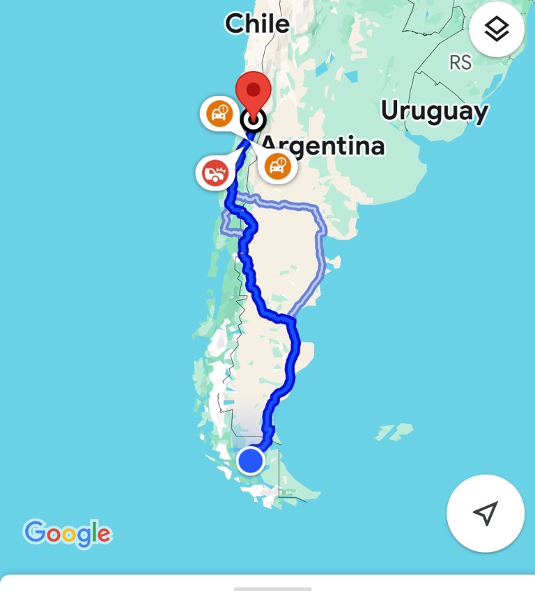
Getting closer.
Sleeping here tonight in Punta Arenas Chile— the southern most city in Chile
Then flying to catch the ship tomorrow.
Will be in full gear boarding the plane tomorrow. Because we go to the Zodiacs straight from the plane. \240

Views from the plane.


Punta Arenas Airport.

It is windy here alllll the time. The trees attest to that💨

![]()
![]()
![]()
![]()
![]()
![]()
OR
Copy the link to @TyB Journo below
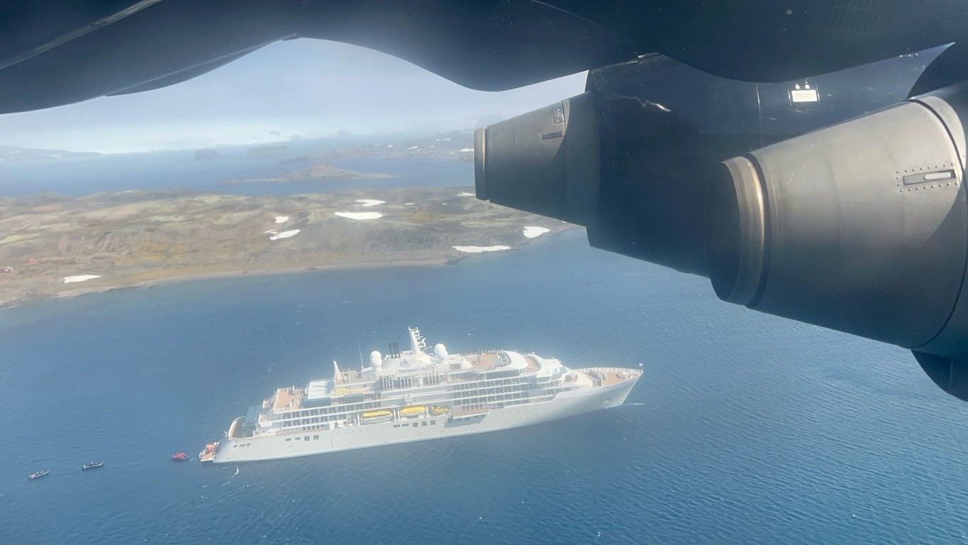
Jan 06 2025
Off to the land of penguins and glaciers.
Flight from Punta Arenas to King George Island Chile.
Then a Zodiac ride to the ship.


Here’s our plane. All geared up and ready to go.


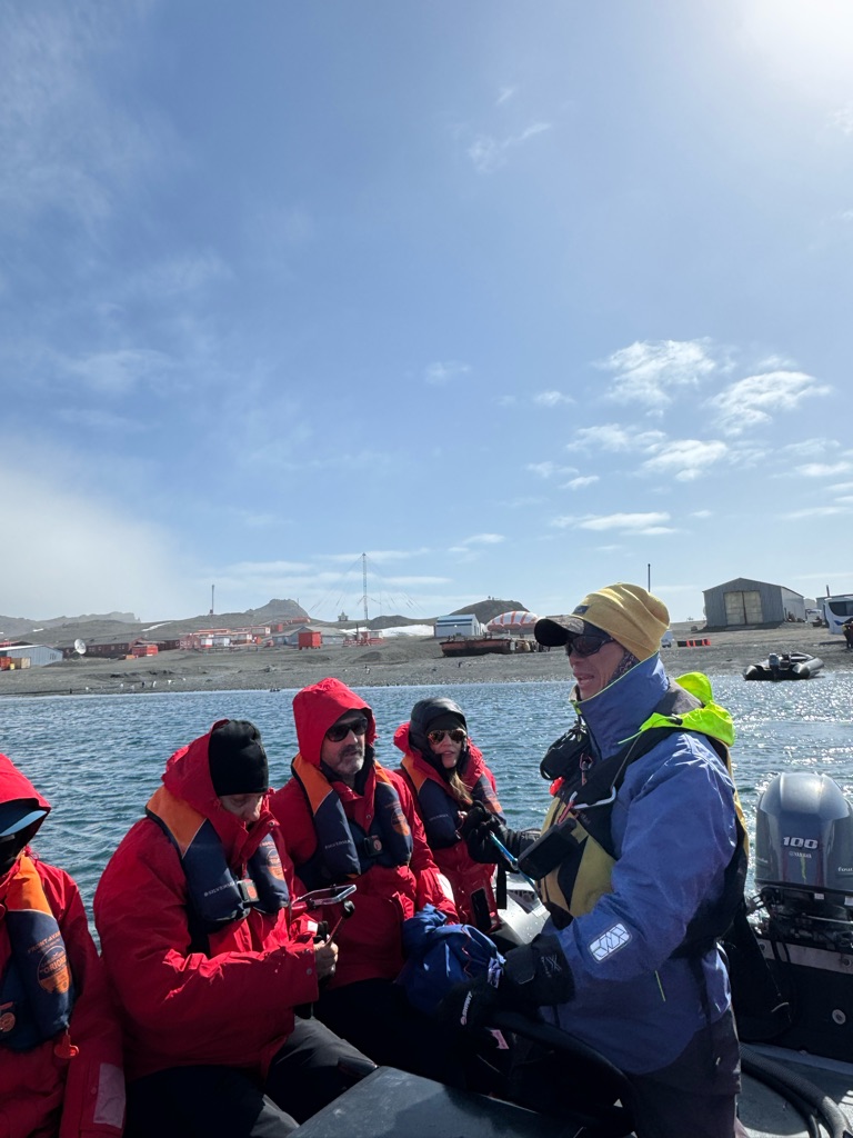


The ship is cozy. People are friendly and we are ready for our first experience, tomorrow


![]()
![]()
![]()
![]()
![]()
![]()
OR
Copy the link to @TyB Journo below
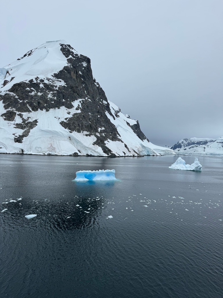
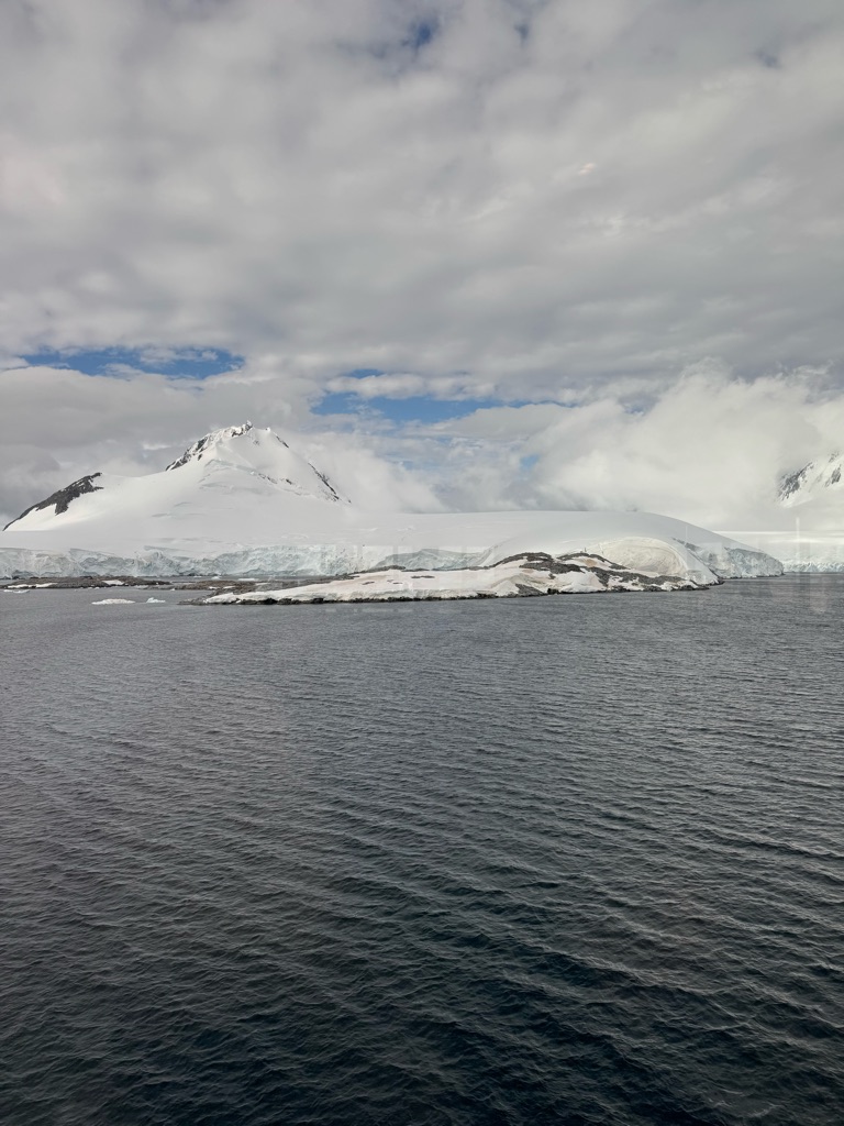
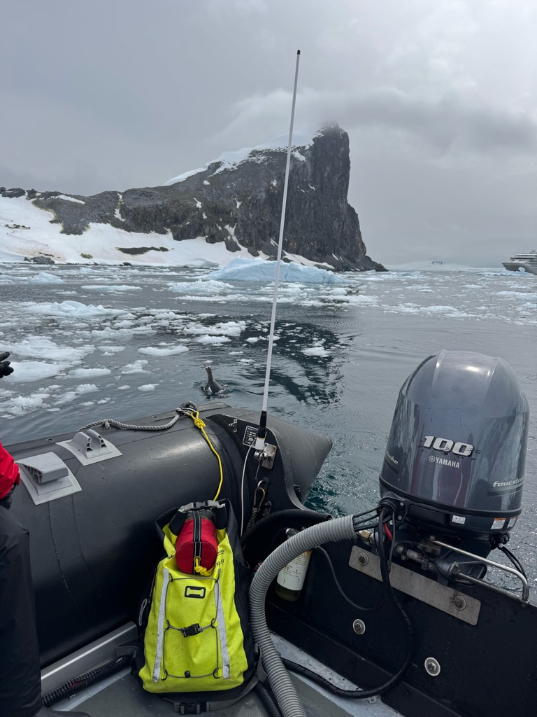
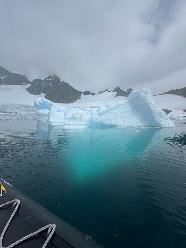
Jan 07 2025
Our first zodiac trip to tour around the Melchior Islands
Beautiful snowy/ windy/ sleety afternoon on the Southern Ocean.


Sailing into the Antarctic Sound.
![]()
![]()
![]()
![]()
![]()
![]()
OR
Copy the link to @TyB Journo below
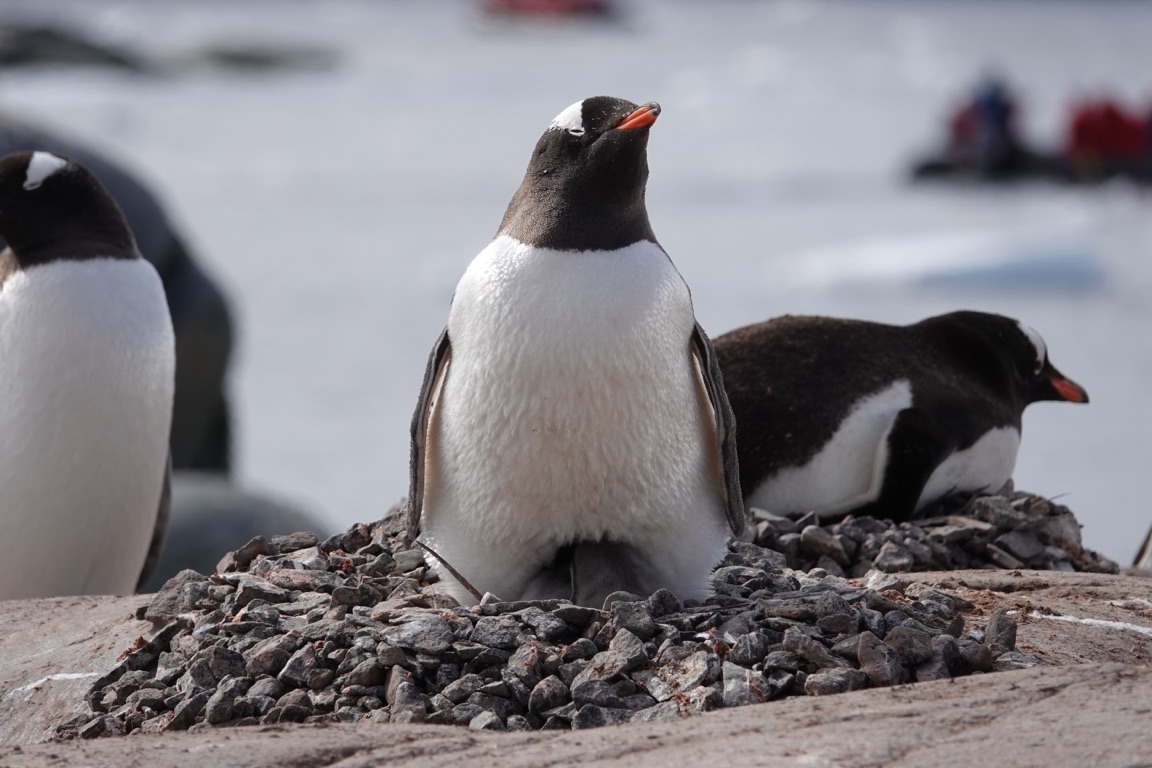
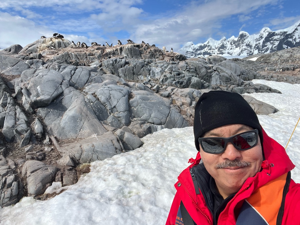
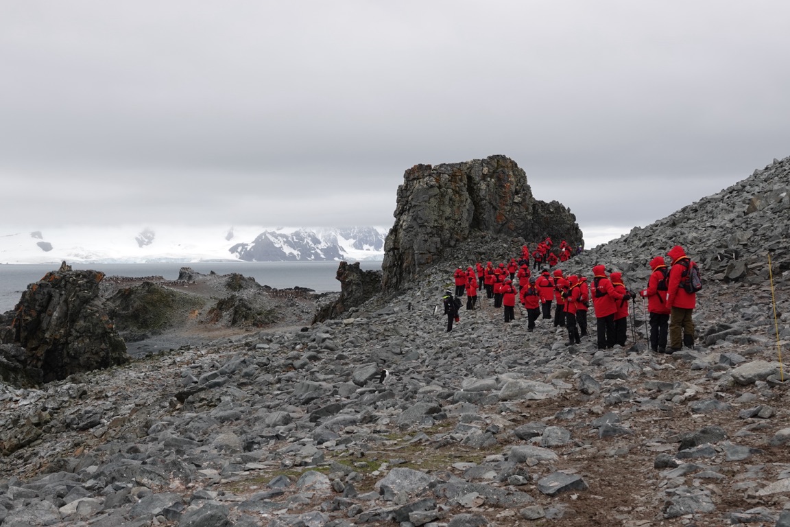
Jan 08 2025
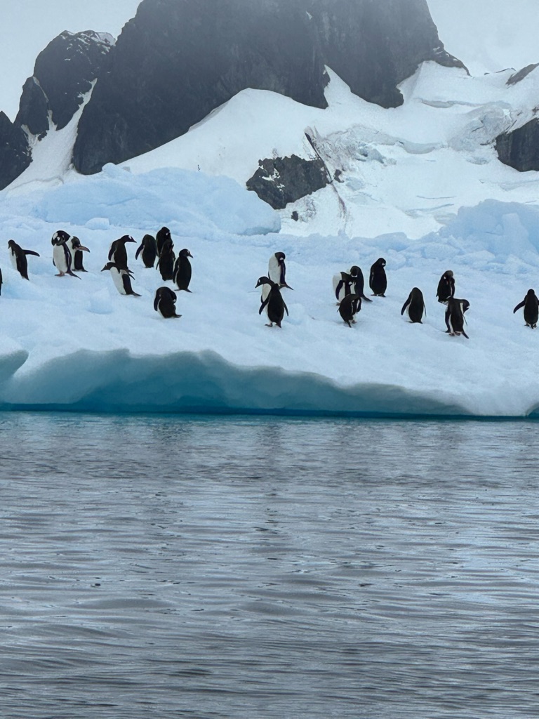
Zodiac visits to the island today
With ‘wet landings’.The \240Boots they gave us are amazing dry and warm.


Gentoo Penguins


Gentoo Penguin


A survival hut.

Weddell Seal
Zoom in and look at the face🥰


Leopard Seal
![]()
![]()
![]()
![]()
![]()
![]()
OR
Copy the link to @TyB Journo below
![]()
![]()
![]()
![]()
![]()
![]()
OR
Copy the link to @TyB Journo below
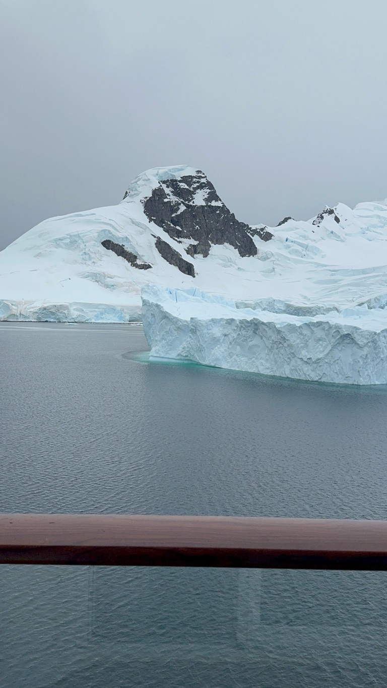
Jan 10 2025


Baby chick with mama penguin

Chinstrap Penguin


Toasting the Antarctic and saying goodbye to this amazing continent
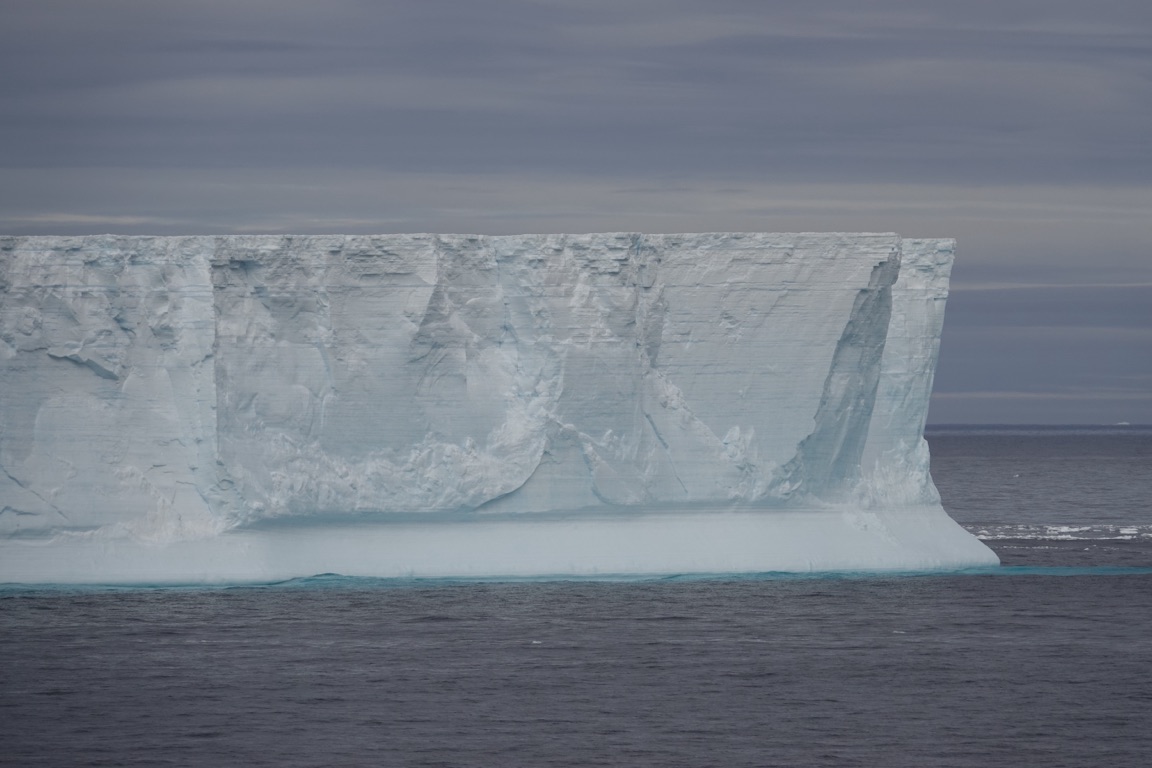
Tabular iceberg seen from the ship

A tabular iceberg is a type of iceberg with steep sides and a flat top, similar to a plateau. They are also known as ice islands and can be very large.

We are leaving te \240Antarctic 6 hours early to get ahead of this weather.
We like blue and green not pink and red in the map. Blue and green is the calmer weather.
The captain is hustling with \240no bumpy rides …yet:)
![]()
![]()
![]()
![]()
![]()
![]()
OR
Copy the link to @TyB Journo below
Jan 12 2025
We are on our second sea day enroute to South Georgia, and South Sandwich Islands
We were fortunate to see the largest iceberg in the world the A23a
Captain Kai rerouted a bit so that we could spend 30 minutes with this floating iceberg.
A23a is the world's largest iceberg, and it's currently drifting in the Southern Ocean:
Size
A23a is about 3,900 square kilometers in area, which is more than twice the size of Greater London. It's also about 400 meters thick, which is taller than the London Shard, Europe's tallest skyscraper.
History
A23a calved from the Filchner–Ronne Ice Shelf in 1986. It grounded in the Weddell Sea and became an ice island. In 2020, it started moving again, but got stuck in a rotating column of water near the South Orkney Islands. In December 2024, it broke free and is now drifting in the Southern Ocean.
Future
A23a is expected to leave the Southern Ocean and enter the Atlantic Ocean, where it will likely break up and melt. If it misses South Georgia, it could go as far north as South Africa, where it could impact shipping routes.
Impact
Icebergs can provide nutrients to the waters they pass through, creating thriving ecosystems. However, what difference particular icebergs make to that process is unknown.


Stock picture of the A23a iceberg.
![]()
![]()
![]()
![]()
![]()
![]()
OR
Copy the link to @TyB Journo below
Jan 13 2025
We arrived here last night and settled in beside the mountains for a night of calm seas
We had a few hours yesterday with rough seas, and did not get sick, just dizzy.
Phew.
A beautiful day at South Georgia and Sandwich Islands.
Zodiac tours this morning and ship cruising this afternoon.
Thankful for the sunny weather.


Larsen Harbour
This is where all good icebergs go to die. The A23a will come here and melt away. \240Hopefully it will not do too much damage to this island.

Seals playing around here too.
They like to follow the Zodiacs,because the motors stir up the krill.

Fur Seals


Today, We disembarked the Zodiacs from ‘The Marina’ on the boat because of choppy seas.


![]()
![]()
![]()
![]()
![]()
![]()
OR
Copy the link to @TyB Journo below
Jan 14 2025
We anchored out in the bay and visited the abandoned site of a whaling operation.

Grytviken is a former whaling station on South Georgia Island. It was founded in 1904 as it had the best harbour on this storm-wracked island, with flat ice-free terrain and a fresh water supply. It became South Georgia's principal station and settlement, and a port-of-call for ships heading to Antarctica. The name is Swedish for "Pot Bay" as the settlers found big pots in which earlier parties had boiled up seal fat to extract the oil. 20th-century whaling destroyed the whale populations, and Grytviken was abandoned in 1966. It now has no resident population, but a few staff stay here in summer to manage visitors.


This is also a site of many seals and penguin rookeries.
.

Grytviken is closely associated with the explorer Sir Ernest Shackleton. Shackleton's Imperial Trans-Antarctic Expedition set out from London on 1 August 1914, to reach the Weddell Sea on 10 January 1915, where the pack ice closed in on their ship, Endurance. The ship was broken by the ice on 27 October 1915. The 28 crew members managed to flee to Elephant Island off Antarctica, bringing three small boats with them. Shackleton and five other men managed to reach the southern coast of South Georgia in James Caird. They arrived at Cave Cove, and camped at Peggotty Bluff, from where they trekked to Stromness on the northeast coast. From Grytviken, Shackleton organised a rescue operation to bring home the remaining men.
He again returned to Grytviken during the Shackleton–Rowett Expeditionand this is where he died, aged just 47, shortly after New Year's Day, prior to the expedition heading south to Antarctica. His widow chose South Georgia as his final resting place so this is where he remained. His grave is located south of Grytviken, alongside those of whalers who had died on the island.
On 27 November 2011, the ashes of Frank Wild, Shackleton's "right-hand man," were interred on the right side of Shackleton's grave-site. The inscription on the rough-hewn granite block set to mark the spot reads "Frank Wild 1873–1939, Shackleton's right-hand man." Wild's relatives and Shackleton's only granddaughter, Alexandra Shackleton, attended a service conducted by Richard Hines, rector of the Falkland Islands. The writer Angie Butler discovered the ashes in the vault of BraamfonteinCemetery, Johannesburg, while researching her book The Quest for Frank Wild. She said "His ashes will now be where they were always supposed to be. It just took them a long time getting there."


Shackletons grave


Having a whiskey toast to Ernest Shackleton


A replica of the J Caird Boat
Shackleton and five companions used the James Caird to travel 800 miles across the ocean from Elephant Island to South Georgia during the winter of 1916
![]()
![]()
![]()
![]()
![]()
![]()
OR
Copy the link to @TyB Journo below
Jan 15 2025


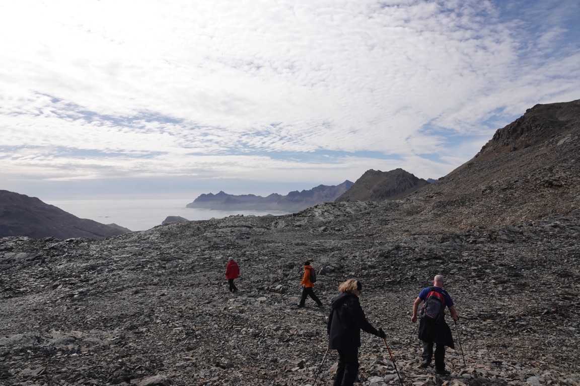
Randy did 3/4 of this mountainous Shackleton walk this morning.
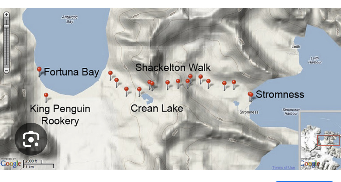


Icebergs in Fortuna Bay


Mensun was director of exploration for two expeditions to the Weddell Sea which led to the rediscovery of the Endurance, in which Sir Ernest Shackleton and a crew of 27 men sailed for the Antarctic on the 1914–1917 Imperial Trans-Antarctic Expedition. The ship sank after being crushed by the ice on the 21st November, 1915, but it was only rediscovered by the Endurance22 expedition in March 2022

3D pictures of the ship that is still and will always be at the bottom of the sea.

We then went to Salisbury Plain and saw over 200 000 penguins.


Our friends Jane and Greg.
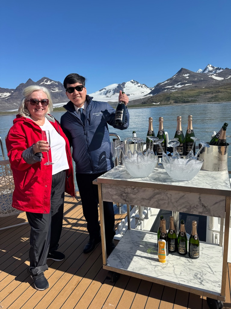

Then the crew had a dance party for us at the Marina- \240the back of the boat.
Gorgeous sunny and warm day!!
![]()
![]()
![]()
![]()
![]()
![]()
OR
Copy the link to @TyB Journo below
Jan 19 2025
Stanley, \240Falkland Islands

The history of the Falkland Islands(Spanish: Islas Malvinas) goes back at least five hundred years, with active exploration and colonisation only taking place in the 18th century. Nonetheless, the Falkland Islandshave been a matter of controversy, as they have been claimed by the French, British, Spaniards and Argentines at various points.
Map of the modern Falkland Islands
The islands were uninhabited when discovered by Europeans. France established a colony on the islands in 1764. In 1765, a British captain claimed the islands for Britain. In early 1770 a Spanish commander arrived from Buenos Aires with five ships and 1,400 soldiers forcing the British to leave Port Egmont. Britain and Spain almost went to war over the islands, but the British government decided that it should withdraw its presence from many overseas settlements in 1774. Spain, which had a garrison at Puerto Soledad on East Falklands, administered the garrison from Montevideo until 1811 when it was compelled to withdraw as a result of the war against Argentine independence and the pressures of Peninsular War. \240Luis Vernetattempted to establish a settlement in 1826, seeking support from both the Argentine and British Governments but most of his settlers took the opportunity to leave in 1831 following a raid by the USS Lexington. An attempt made by Argentina to establish a penal colony in 1832 failed due to a mutiny. In 1833, the British returned to the Falkland Islands. Argentina invaded the islandson 2 April 1982. The British responded with an expeditionary force that forced the Argentines to surrender.
The history of the Falkland Islands(Spanish: Islas Malvinas) goes back at least five hundred years, with active exploration and colonisation only taking place in the 18th century. Nonetheless, the Falkland Islandshave been a matter of controversy, as they have been claimed by the French, British, Spaniards and Argentines at various points.
The islands were uninhabited when discovered by Europeans. France established a colony on the islands in 1764. In 1765, a British captain claimed the islands for Britain. In early 1770 a Spanish commander arrived from Buenos Aires with five ships and 1,400 soldiers forcing the British to leave Port Egmont. Britain and Spain almost went to war over the islands, but the British government decided that it should withdraw its presence from many overseas settlements in 1774. Spain, which had a garrison at Puerto Soledad on East Falklands, administered the garrison from Montevideo until 1811 when it was compelled to withdraw as a result of the war against Argentine independence and the pressures of Peninsular War. \240Luis Vernetattempted to establish a settlement in 1826, seeking support from both the Argentine and British Governments but most of his settlers took the opportunity to leave in 1831 following a raid by the USS Lexington. An attempt made by Argentina to establish a penal colony in 1832 failed due to a mutiny. In 1833, the British returned to the Falkland Islands. Argentina invaded the islandson 2 April 1982. The British responded with an expeditionary force that forced the Argentines to surrender.

Visiting Munson Bound at his home in Stanley


Menson Bound
Mensun Bound (born 4 February 1953) is a British maritime archaeologist born in Stanley, Falkland Islands. He is best known as director of exploration for two expeditions to the Weddell Sea which led to the rediscovery of the Endurance.n which Sir Ernest Shackleton and a crew of 27 men sailed for the Antarctic on the 1914–1917 Imperial Trans-Antarctic Expedition. The ship sank after being crushed by the ice on 21 November 1915. It was rediscovered by the Endurance22 expedition on 5 March 2022.


Black- browed Albatross


Rockhopper Penguin


Joanna. Our cruise director.


![]()
![]()
![]()
![]()
![]()
![]()
OR
Copy the link to @TyB Journo below
Jan 19 2025
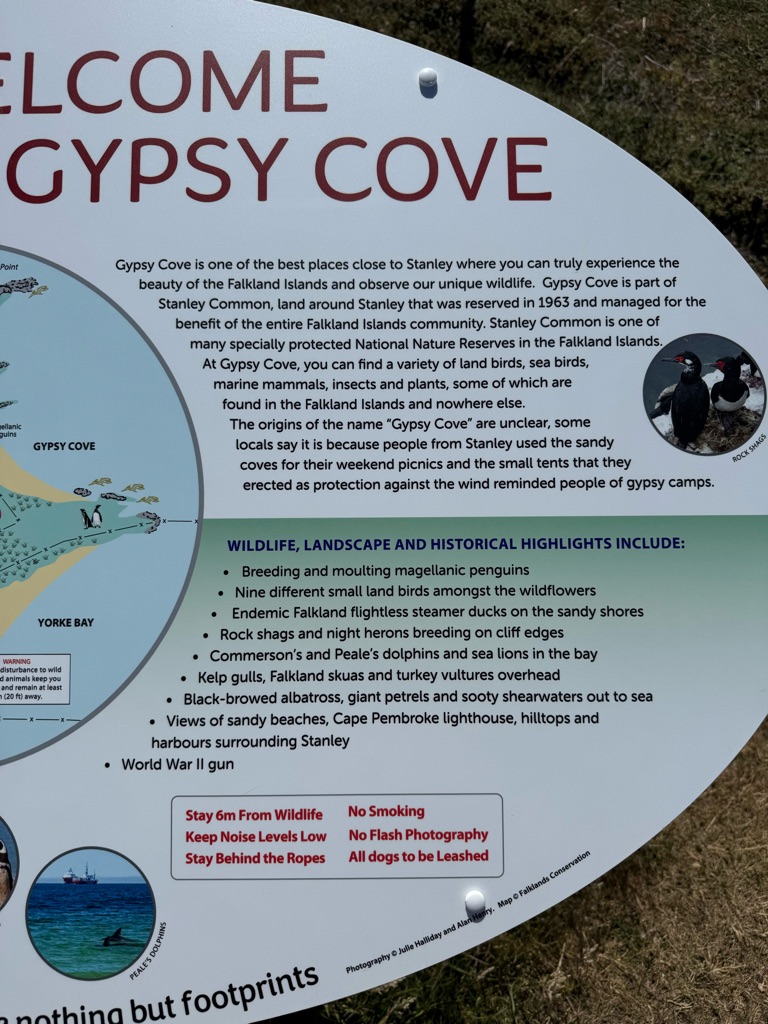
West Point Island Gypsy Cove


New Island, Falkland Islands

Rockhopper Penguin.

![]()
![]()
![]()
![]()
![]()
![]()
OR
Copy the link to @TyB Journo below
Jan 21 2025

And our journey home.
The most amazing experience.
Thank you Peru and Antarctica.
😍🤗🥰✈️🧳🚢🛳️✨
![]()
![]()
![]()
![]()
![]()
![]()
OR
Copy the link to @TyB Journo below
![]()
![]()
![]()
![]()
![]()
![]()
OR
Copy the link to @TyB Journo below